FIELD NOTES / NEIGHBORHOOD GUIDES
78745 Austin, TX: what's in the ZIP code, home prices, taxes and flood zones
78745 is a 13.7-square-mile South Austin ZIP code where Realtor.com put the median list price at $450,000 in September 2026, down 5.3% from a year earlier, at $334 a square foot. Most of 78745 is inside the City of Austin, but about 9% of its land is the separate City of Sunset Valley, which keeps a $0.00 municipal property tax rate, and 43% of the ZIP's homes were built before 1980, according to the Census Bureau. This guide covers the neighborhoods, prices since 2019, housing stock, taxes on each side of the city line, flood zones, parks and transit.
By David Eimer · Austin Journal · 9 minute read · Published
The numbers
- Median list price, ZIP 78745
- $450,000As of September 2026
Down 5.3% from a year earlier; $334 per square foot; 294 active listings; median 71 days on market.
Source: Realtor.com Economic Research ↗
- Listings with a price cut, 78745
- 29.1%As of September 2026
Austin metro: 27.3%.
Source: Realtor.com Economic Research ↗
- Homes in 78745 built before 1980
- 43.4%As of ACS 2020-2024 5-year estimates
Computed from the decade shares; 24.3% were built in the 1970s alone. City of Austin: 28.2% before 1980.
Source: U.S. Census Bureau ↗
- Median owner-estimated home value, 78745
- $504,800As of ACS 2020-2024 5-year estimates
46.3% of occupied homes are owner-occupied. City of Austin median: $555,300.
Source: U.S. Census Bureau ↗
- City of Sunset Valley municipal property tax rate
- $0.00As of FY 2026-27 budget, adopted September 15, 2026
About 9% of ZIP 78745's land area is inside Sunset Valley's city limits.
Source: City of Sunset Valley ↗
- Share of 78745 land in FEMA's 1% annual chance flood zone
- About 8.3%As of FEMA National Flood Hazard Layer, queried October 5, 2026
Computed against the Census ZIP boundary; 10.4% including the 0.2% annual chance (500-year) zone.
Source: FEMA ↗
Where is 78745, and what neighborhoods are in the ZIP code?
ZIP code 78745 covers 13.7 square miles of South Austin, measured by the Census Bureau's ZIP Code Tabulation Area, and its center is 9.0 road miles from the Texas State Capitol, a computed route of about 17 minutes without traffic. ZIP codes are mail-delivery areas, so the line does not follow neighborhood, school or city boundaries, and a 78745 mailing address can sit in either of two cities.
About 90.8% of the ZIP's land is inside the City of Austin's full-purpose city limits, according to the City's jurisdiction map, and about 9.0% is the City of Sunset Valley, a separate municipality with its own council, budget and codes. The Census Bureau's place boundaries put 88.7% of Sunset Valley's land inside 78745, so most Sunset Valley addresses carry the 78745 ZIP.
On the Austin side, six City of Austin neighborhood planning areas sit almost entirely inside 78745: Garrison Park, South Manchaca, East Congress, Sweetbriar, Westgate and West Congress. Together they cover about 49% of the ZIP's land; the rest of 78745 lies outside the City's planning-area map or in Sunset Valley.
City of Austin neighborhood planning areas inside ZIP code 78745 (computed overlap)
| Planning area | Share of the planning area inside 78745 | Share of 78745's land |
|---|---|---|
| Garrison Park | 100% | 14.3% |
| South Manchaca | 99.5% | 10.1% |
| East Congress | 93.4% | 8.2% |
| Sweetbriar | 99.0% | 6.8% |
| Westgate | 97.2% | 5.9% |
| West Congress | 91.7% | 3.9% |
| City of Sunset Valley (separate city) | 88.7% | 9.0% |
A planning area is a City land-use unit, not a subdivision or an HOA, so a single planning area can hold several subdivisions built decades apart. The South Austin neighborhoods guide compares 78745 with the ZIP codes around it.
Sources: U.S. Census Bureau TIGERweb ↗ · City of Austin ↗ · OSRM routing over OpenStreetMap roads, ZIP center to the Texas State Capitol, computed October 5, 2026 ↗
78745 home prices in September 2026
The median list price in ZIP code 78745 was $450,000 in September 2026, down 5.3% from a year earlier, according to Realtor.com's monthly ZIP data. Listings asked a median $334 a square foot, there were 294 active listings and 68 pending, and the median listing had been on the market 71 days, 7.5% fewer than a year earlier. 29.1% of active listings had cut their price at least once.
The 78745 median list price sits close to the Austin metro's $446,450, but the price per square foot does not: 78745's $334 is about 46% above the metro's $228 (computed). The same budget buys a smaller house in 78745 than the metro median suggests, which points to smaller homes on average than the metro's newer suburban stock.
78745 and neighboring South Austin ZIP codes, September 2026
| Area | Median list price | Change from a year earlier | Price per sq ft | Active listings | Median days on market | Listings with a price cut |
|---|---|---|---|---|---|---|
| 78745 | $450,000 | −5.3% | $334 | 294 | 71 | 29.1% |
| 78744 | $383,723 | −0.1% | $216 | 138 | 62 | 18.2% |
| 78748 | $412,500 | −6.0% | $225 | 162 | 67 | 34.3% |
| 78749 | $575,000 | +0.1% | $298 | 103 | 52 | 31.8% |
| Austin metro | $446,450 | −9.8% | $228 | 12,083 | 80 | 27.3% |
Realtor.com counts list prices, not closed sales, and a ZIP median moves with the mix of homes listed that month. Realtor.com flagged its September figures for 78704 as lower quality, so that ZIP is left off the table. The Austin market page has the metro sales figures from the MLS.
Sources: Realtor.com Economic Research ↗
How have 78745 home prices changed since 2019?
78745 list prices rose fast through 2021 and have drifted down since the spring 2022 peak. Realtor.com's ZIP history puts the 78745 median list price at $359,943 in September 2019 and at a high of $627,000 in May 2022; September 2026's $450,000 is 28.2% below that peak and 25.0% above September 2019 (both computed).
Inventory tells the same story from the other side. In May 2022, 78745 had 53 active listings and the median listing had been on the market 16 days; in September 2026 there were 294 listings, about 5.5 times as many (computed), and the median stayed on the market 71 days.
ZIP 78745 listings each September since 2019, and the May 2022 peak
| Month | Median list price | Active listings | Median days on market | Price per sq ft |
|---|---|---|---|---|
| September 2019 | $359,943 | 134 | 36 | $248 |
| September 2020 | $394,725 | 97 | 30 | $287 |
| September 2021 | $543,725 | 80 | 23 | $394 |
| May 2022 (peak) | $627,000 | 53 | 16 | $430 |
| September 2022 | $579,999 | 185 | 41 | $402 |
| September 2023 | $545,000 | 250 | 58 | $392 |
| September 2024 | $500,500 | 256 | 61 | $368 |
| September 2025 | $475,000 | 329 | 77 | $344 |
| September 2026 | $450,000 | 294 | 71 | $334 |
The trend inside 2026 has been flat to slightly lower: the median list price was $482,750 in January, $475,000 in May and $450,000 from July to September. For a buyer, that means a 78745 seller today competes with more listings than in any September from 2016 through 2024; only September 2025, at 329, had more. For a seller, it means pricing to the current comparable sales, not to what a neighbor's house asked in 2022.
Sources: Realtor.com Economic Research ↗
What kind of houses are in 78745?
78745 is mostly single-family housing from the 1960s, 1970s and 1980s. The Census Bureau's 2020-2024 American Community Survey counts 31,805 housing units in the ZIP; 53.7% are detached single-family houses, against 43.4% in the City of Austin, and 18.5% are in buildings of 20 or more units, against 26.1% citywide.
The 1970s were the busiest decade: 24.3% of 78745's housing units were built from 1970 to 1979, and 54.0% between 1960 and 1989 (computed). Only 19.5% were built in 2010 or later, compared with 26.2% citywide. Owner-occupied homes are 46.3% of occupied units in 78745 and 43.4% in Austin.
When the housing was built: ZIP 78745 vs. the City of Austin (share of housing units)
| Year built | 78745 | City of Austin |
|---|---|---|
| 2020 or later | 4.4% | 4.8% |
| 2010 to 2019 | 15.1% | 21.4% |
| 2000 to 2009 | 11.4% | 17.0% |
| 1990 to 1999 | 7.5% | 11.9% |
| 1980 to 1989 | 18.4% | 16.6% |
| 1970 to 1979 | 24.3% | 13.3% |
| 1960 to 1969 | 11.3% | 6.9% |
| 1950 to 1959 | 6.0% | 4.0% |
| 1949 or earlier | 1.8% | 4.0% |
A house from the 1970s or 1980s brings its own inspection list: original electrical panels, galvanized or cast-iron drain lines, foundation movement on clay soils and HVAC systems at the end of their life. The guide to buying an older Austin home covers what to inspect, and the Austin permit history guide shows how to check whether past additions and remodels were permitted. ACS figures are five-year survey estimates with margins of error, and they include Sunset Valley.
Sources: U.S. Census Bureau ↗
Property taxes in 78745: Austin city limits vs. Sunset Valley
Two 78745 homes on either side of the Sunset Valley city line pay different tax bills. TCAD's taxing-unit lookup lists five units for an address inside Austin (Travis County, Central Health, City of Austin, Austin Community College and Austin ISD) and swaps the City of Austin for the City of Sunset Valley at a Sunset Valley address. Sunset Valley's FY 2026-27 budget keeps the municipal property tax rate at $0.00 and budgets about $7.22 million in sales tax revenue across City funds; the council adopted the budget on September 15, 2026.
At the 2026 rates on the Travis County Tax Office list, with Austin ISD's proposed $0.9184, a homestead inside Austin pays $2.121064 per $100 of value and one in Sunset Valley $1.541116 (computed). On a $450,000 homestead, the 78745 median list price, that is $7,264.73 a year inside Austin and $5,176.92 in Sunset Valley, a difference of $2,087.81, the City of Austin line.
2026 property tax on a $450,000 homestead in 78745: inside Austin vs. Sunset Valley (computed)
| Taxing unit | 2026 rate per $100 | Taxable value after homestead exemption | Inside Austin | Inside Sunset Valley |
|---|---|---|---|---|
| Travis County | $0.386210 | $360,000 | $1,390.36 | $1,390.36 |
| Central Health | $0.132863 | $360,000 | $478.31 | $478.31 |
| City of Austin | $0.579948 | $360,000 | $2,087.81 | Not levied |
| City of Sunset Valley | $0.00 | n/a | Not levied | $0.00 |
| Austin Community College | $0.103643 | $445,000 | $461.21 | $461.21 |
| Austin ISD (proposed) | $0.9184 | $310,000 | $2,847.04 | $2,847.04 |
| Total | $7,264.73 | $5,176.92 |
The example applies each unit's homestead exemption: 20% for the county, Central Health and the City, $5,000 for ACC and the state's $140,000 for Austin ISD. It leaves out over-65 and disability exemptions, and Austin ISD had not yet posted a final 2026 rate when this was published. The Travis County property tax guide explains each line.
Sources: Travis Central Appraisal District ↗ · City of Sunset Valley ↗ · Travis County Tax Office ↗ · Austin ISD ↗
Is 78745 in a flood zone?
About 8.3% of the land in ZIP code 78745 is in FEMA's 1% annual chance flood zone (Zones A and AE, the Special Flood Hazard Area), and 10.4% is in either that zone or the 0.2% annual chance zone, computed by overlaying FEMA's National Flood Hazard Layer on the Census ZIP boundary. Citywide, the City of Austin's Watershed Protection Department says about 10% of land in Austin is in the floodplain.
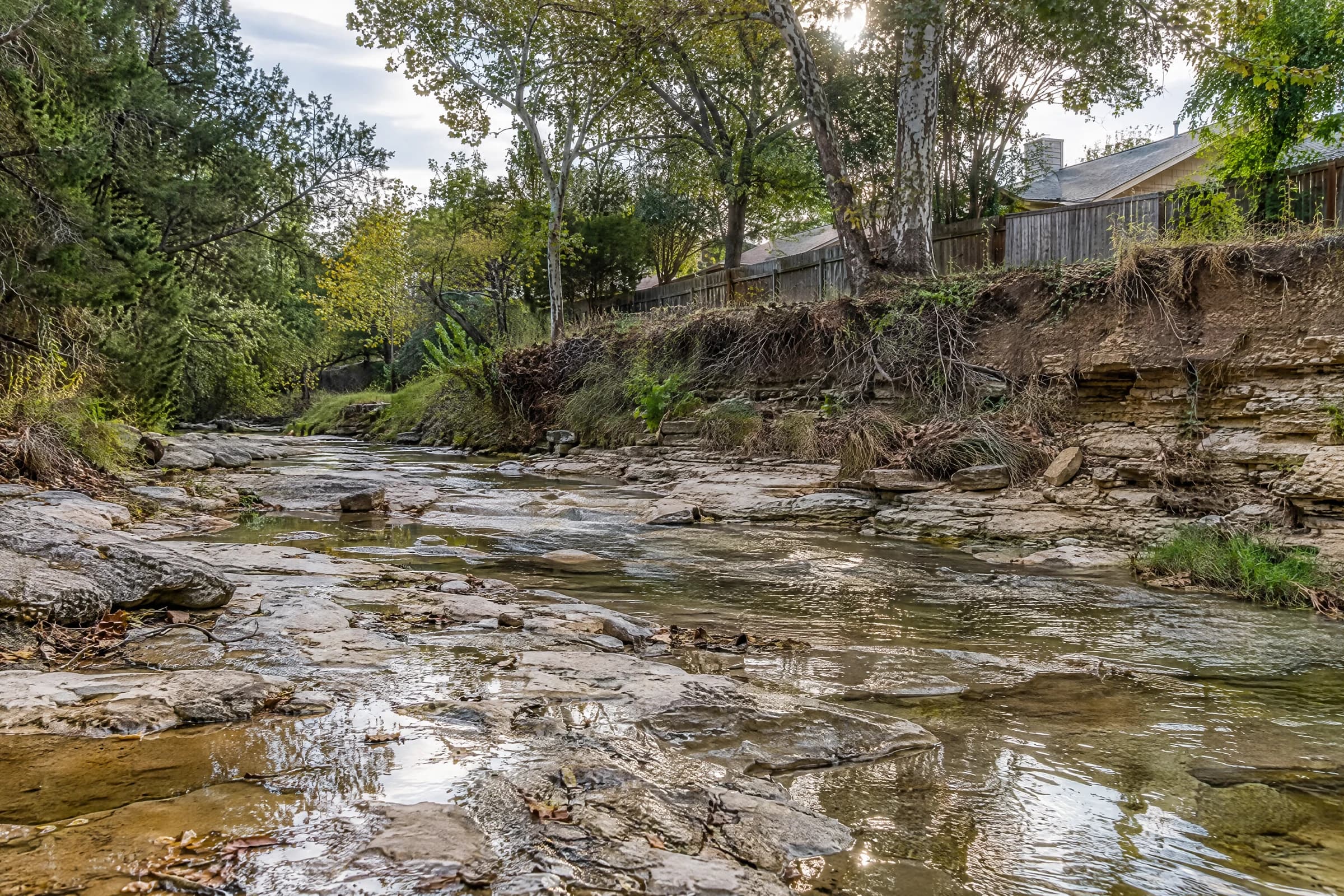
The flood zones in 78745 follow its creeks. The City's creek map puts about 6.6 miles of Williamson Creek channel inside the ZIP, along with 3.3 miles of South Boggy Creek and shorter runs of the Sunset Valley Tributary, Cherry Creek Branch, Kincheon Branch and Pleasant Hill (computed lengths). Flood exposure in 78745 therefore varies street by street, and two houses a block apart can sit on opposite sides of the line.
The 0.2% zone matters more in Austin than the name suggests. After the Atlas 14 rainfall study, the City's floodplain page says its regulations now "base development regulations on the current FEMA 500-year floodplain, instead of the 100-year floodplain." Check FloodPro and FEMA for the exact parcel, as the Austin flood map guide explains, before you write an offer.
Sources: FEMA ↗ · City of Austin Watershed Protection ↗ · City of Austin ↗
Parks, greenbelts and transit in 78745
The City of Austin's park map shows 23 City parks mostly inside 78745, totaling about 379 acres (computed). The largest are Stephenson Nature Preserve and Outdoor Education Center (147 acres, 7501 Longview Road), the Williamson Creek Central Greenbelt (93 acres, 5120 S. 1st Street) and James A. Garrison District Park (40 acres, 6001 Menchaca Road). Longview, Davis Hill, Joslin, Cooper and Battlebend Springs are among the neighborhood parks.
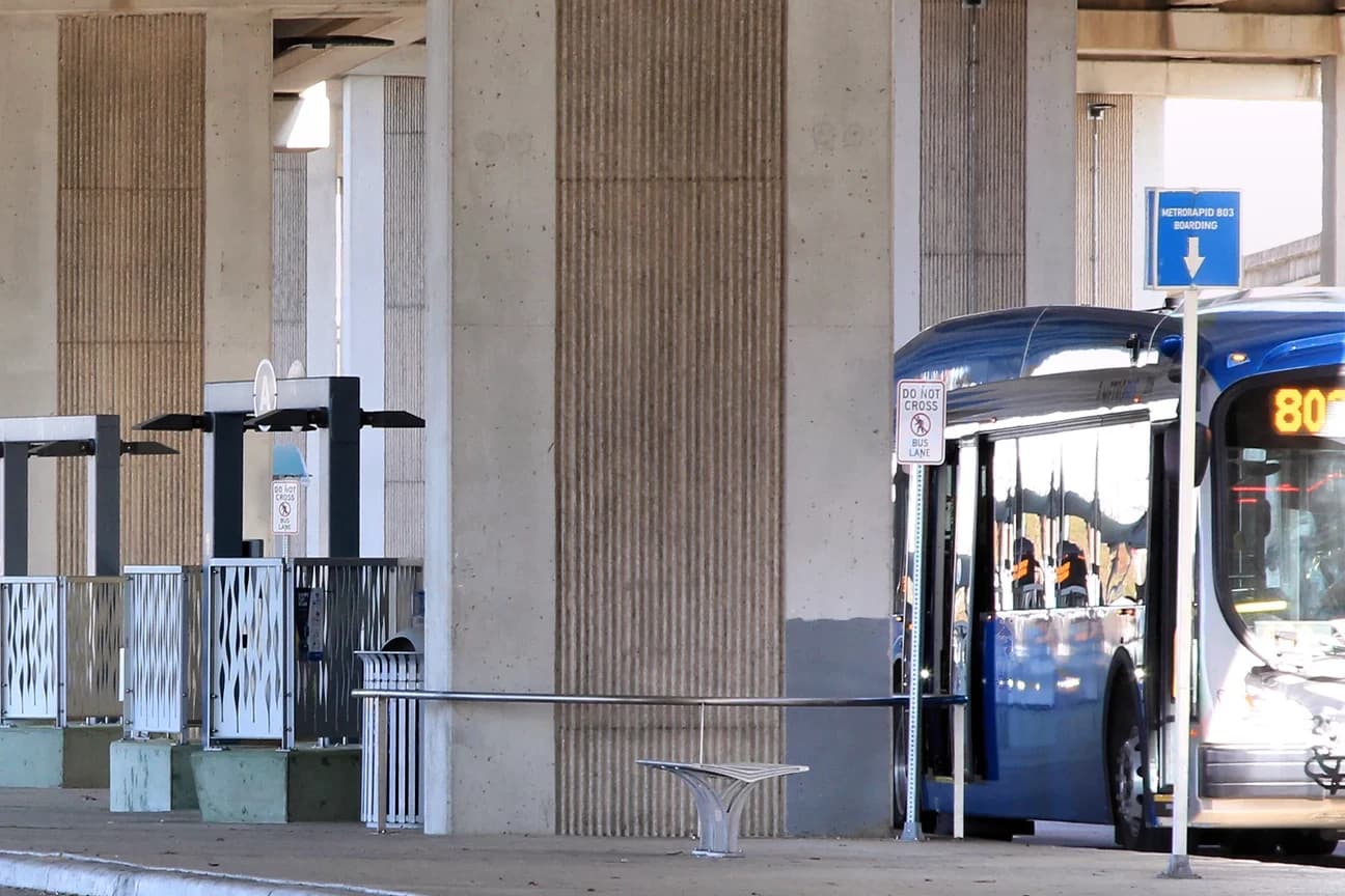
Two CapMetro Rapid lines reach the ZIP. Route 801 North Lamar/South Congress "connects Tech Ridge to Southpark Meadows via UT and downtown," along the South Congress corridor that passes through the East Congress and West Congress planning areas, and Route 803 Burnet/South Lamar "connects The Domain to Westgate via UT and downtown," ending at the Westgate Transit Center on Ben White Boulevard, just across the ZIP's northern line.
CapMetro's page says a Rapid bus comes "every 10-15 minutes." Both lines follow fixed corridors, so check the stop nearest the specific address on CapMetro's map rather than assuming the whole ZIP is served. Drive the route at the hour you would commute before you buy; the route test for a move to Austin walks through it.
Sources: City of Austin ↗ · CapMetro ↗
What to check before buying a home in 78745
Start with the city line. Look up the address in TCAD's property search or taxing-unit lookup and confirm whether it is in the City of Austin or Sunset Valley; the answer changes the tax bill by thousands of dollars, the building code and permit office, and whether Austin's HOME rules apply. HOME lets an SF-1, SF-2 or SF-3 lot inside Austin hold "up to three housing units," and a single home on a lot as small as 1,800 square feet, which matters to a buyer planning a second unit or watching what may be built next door. HOME is City of Austin code, so it does not reach Sunset Valley.
Then check the parcel's flood status in FloodPro, the permit history of any addition, the age of the roof, panel and drain lines, and whether the listing has had price cuts. In a ZIP where 29.1% of listings have cut their price, the listing history is part of the negotiation.
Finally, price the monthly payment. At the 7.28% national 30-year average Freddie Mac reported on October 1, 2026, a $360,000 loan on a $450,000 home costs $2,463.16 a month in principal and interest (computed), plus about $605 a month in property tax inside Austin. David can pull the comparable sales for a specific 78745 street and walk through those numbers with you.
Sources: Travis Central Appraisal District ↗ · City of Austin Development Services ↗ · City of Austin ↗ · Realtor.com Economic Research ↗ · Freddie Mac Primary Mortgage Market Survey via FRED ↗
Common questions
What part of Austin is 78745?
78745 is a South Austin ZIP code of 13.7 square miles whose center is about 9 road miles from the Texas State Capitol. It holds the Garrison Park, South Manchaca, East Congress, Sweetbriar, Westgate and West Congress planning areas and most of the separate City of Sunset Valley, which covers about 9% of the ZIP's land.
What is the median home price in 78745?
Realtor.com put the median list price in ZIP code 78745 at $450,000 in September 2026, down 5.3% from a year earlier, at $334 a square foot, with 294 active listings and a median of 71 days on market. The ZIP's list price peaked at $627,000 in May 2022. These are asking prices, not closed sales.
Is Sunset Valley in 78745, and does Sunset Valley have a property tax?
Yes. About 88.7% of the City of Sunset Valley's land is inside ZIP code 78745, by Census Bureau boundaries. Sunset Valley's FY 2026-27 budget, adopted September 15, 2026, keeps its municipal property tax rate at $0.00, so a Sunset Valley homestead pays county, Central Health, ACC and Austin ISD taxes but no city property tax.
How old are the homes in 78745?
The Census Bureau's 2020-2024 American Community Survey estimates that 43.4% of 78745's housing units were built before 1980 and 24.3% in the 1970s alone, compared with 28.2% before 1980 across the City of Austin. Detached single-family houses are 53.7% of the ZIP's 31,805 housing units.
Is 78745 in a flood zone?
Parts of it are. About 8.3% of 78745's land is in FEMA's 1% annual chance flood zone and 10.4% including the 0.2% annual chance zone, mostly along Williamson Creek and South Boggy Creek. The City of Austin regulates development to the FEMA 500-year line, so check an address in FloodPro before buying.
Take this to your next conversation
- Look the address up in TCAD and confirm whether it is inside the City of Austin or Sunset Valley before comparing tax bills.
- Open the parcel in FloodPro and FEMA's Flood Map Service Center, and compare the City's line with FEMA's.
- Pull the permit history for any addition, garage conversion or second unit.
- Plan inspections for a 1960s-1980s house: electrical panel, drain lines, foundation and HVAC.
- Ask for the listing's price history; 29.1% of 78745 listings had a price cut in September 2026.
- Price the monthly payment with taxes for the specific taxing units on the parcel.
Sources and review date
Sources checked . Planning suggestions are editorial guidance; current property facts and requirements need an address-specific check.
- Realtor.com Economic Research: monthly housing inventory data by ZIP and metro, September 2026 ↗
- Realtor.com Economic Research: ZIP code inventory history (RDC_Inventory_Core_Metrics_Zip_History.csv) ↗
- U.S. Census Bureau: American Community Survey 2020-2024 5-year, DP04 Selected Housing Characteristics, ZCTA5 78745 ↗
- U.S. Census Bureau: American Community Survey 2020-2024 5-year, DP04 Selected Housing Characteristics, Austin city, Texas ↗
- U.S. Census Bureau TIGERweb: 2020 ZIP Code Tabulation Areas and Incorporated Places layers ↗
- City of Austin: jurisdictions map layer (BOUNDARIES_jurisdictions) ↗
- City of Austin: Neighborhood plans and resources (neighborhood planning areas) ↗
- OSRM routing over OpenStreetMap roads, ZIP center to the Texas State Capitol, computed October 5, 2026 ↗
- City of Sunset Valley: Fiscal Year 2026-2027 Budget ↗
- Travis Central Appraisal District: property search and taxing-unit lookup ↗
- Travis County Tax Office: tax rates by taxing unit, 2026 and prior years (spreadsheet) ↗
- Austin ISD: Taxpayer Impact Statement, Tax Year 2026 (PDF) ↗
- Travis Central Appraisal District: 2026 exemption listing (PDF) ↗
- FEMA: National Flood Hazard Layer, Flood Hazard Zones (map service) ↗
- City of Austin Watershed Protection: Floodplain management ↗
- City of Austin: View floodplain maps and storm drain infrastructure (FloodPro) ↗
- City of Austin: creek centerlines map layer (INLANDWATERS_creeks_lines) ↗
- City of Austin: park boundaries map layer (BOUNDARIES_city_of_austin_parks) ↗
- CapMetro: CapMetro Rapid routes ↗
- City of Austin Development Services: HOME amendments ↗
- Freddie Mac Primary Mortgage Market Survey via FRED: 30-year fixed rate (MORTGAGE30US), week of October 1, 2026 ↗