FIELD NOTES / NEIGHBORHOOD COMPARISONS
South Austin neighborhoods by ZIP code: prices, price cuts and miles to downtown, September 2026
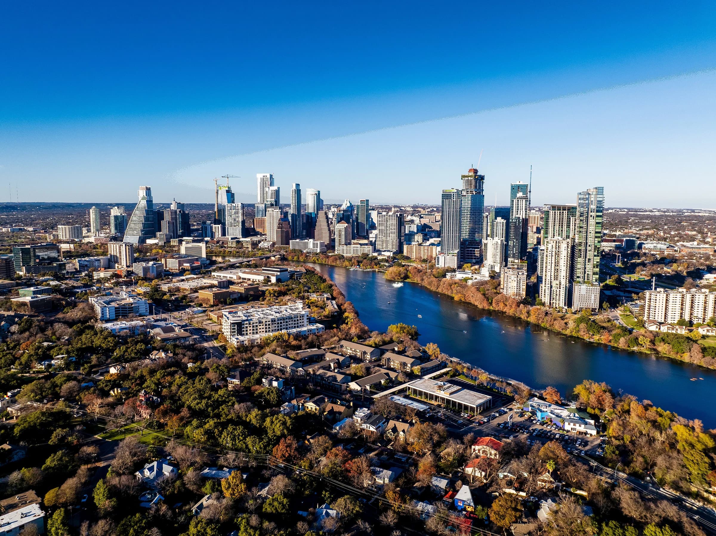
South Austin neighborhoods split into seven ZIP codes with very different price points: Realtor.com's August 2026 data puts the median list price at $774,950 in 78704 (Bouldin Creek, Travis Heights, Dawson) and $358,000 in 78744 (Franklin Park, Southeast), against $450,000 for the Austin metro. This guide compares every South Austin ZIP on list price, price per square foot, days on market, price cuts and computed road miles to the Texas State Capitol, and names the City of Austin planning areas inside each one.
By David Eimer · Austin Journal · 8 minute read · Published
The numbers
- Median list price, 78704
- $774,950As of August 2026
Down 8.2% from a year earlier; $516 per square foot.
Source: Realtor.com Economic Research ↗
- Median list price, 78745
- $454,000As of August 2026
Down 5.3% from a year earlier; 303 active listings, the most of any South Austin ZIP after 78704.
Source: Realtor.com Economic Research ↗
- Median list price, 78744
- $358,000As of August 2026
Down 7.0% from a year earlier; $215 per square foot.
Source: Realtor.com Economic Research ↗
- Share of listings with a price cut, 78749
- 43.1%As of August 2026
The highest share of any South Austin ZIP; the metro figure is 27.6%.
Source: Realtor.com Economic Research ↗
- Median list price, Austin metro
- $450,000As of August 2026
Down 9.8% from a year earlier; median 73 days on market.
Source: Realtor.com Economic Research ↗
- 30-year fixed mortgage rate, U.S.
- 7.03%As of September 24, 2026
Source: Freddie Mac ↗
Which ZIP codes and neighborhoods make up South Austin?
South Austin has no official boundary, but the City of Austin divides the area south of Lady Bird Lake into neighborhood planning areas, and those planning areas fall into a handful of ZIP codes. Checking the city's planning-area boundaries against the Census Bureau's ZIP code areas puts Bouldin Creek, Dawson and South River City, the planning area that holds Travis Heights, in 78704. South Manchaca, Garrison Park and most of West Congress sit in 78745, and Westgate straddles 78704 and 78745.
Farther out, East Oak Hill falls mostly in 78735 and West Oak Hill spreads across 78735, 78736, 78737 and 78749. Franklin Park lies in 78744, the Southeast planning area splits between 78741 and 78744, and Riverside and Montopolis sit in 78741. Planning areas are how the city writes neighborhood plans; they are not the names on every subdivision sign, so an address can carry a subdivision or homeowners-association name that appears nowhere in this list.
City of Austin planning areas in each South Austin ZIP code
| ZIP | Planning areas inside |
|---|---|
| 78704 | Bouldin Creek, Dawson, South River City, part of Westgate |
| 78745 | South Manchaca, Garrison Park, most of West Congress |
| 78749 | Part of West Oak Hill |
| 78744 | Franklin Park, part of Southeast |
| 78735, 78736, 78737 | East Oak Hill (mostly 78735); West Oak Hill spreads across all three and 78749 |
| 78741 | Riverside, Montopolis, part of Southeast |
ZIP codes matter because they are the smallest geography with reliable monthly price data. Realtor.com publishes list prices, price cuts and days on market for each ZIP every month; no public source publishes the same figures for a single neighborhood. Every price below is therefore a ZIP-wide figure, and a single street can sit well above or below it.
Sources: City of Austin ↗ · U.S. Census Bureau ↗ · Realtor.com Economic Research ↗
South Austin home prices by ZIP code, August 2026
South Austin list prices run from $363,000 to $796,750 across the seven ZIP codes with clean August 2026 data, according to Realtor.com. The two most expensive, 78739 at $796,750 and 78704 at $774,950, sit on opposite sides of the area: one at the southwest edge of the city and one directly across Lady Bird Lake from downtown. The two least expensive, 78744 at $358,000 and 78747 at $363,000, are in the southeast.
South Austin ZIP codes compared, August 2026
| ZIP | Median list price | vs. a year earlier | Price per sq. ft. | Median days on market | Listings with a price cut | Road miles to the Capitol |
|---|---|---|---|---|---|---|
| 78704 | $774,950 | −8.2% | $516 | 86 | 23.7% | 3.3 |
| 78745 | $454,000 | −5.3% | $334 | 66 | 27.3% | 9.1 |
| 78748 | $419,500 | −6.8% | $234 | 57 | 37.3% | 12.6 |
| 78749 | $575,000 | −2.5% | $300 | 53 | 43.1% | 10.1 |
| 78739 | $796,750 | −0.3% | $304 | 55 | 39.6% | 14.6 |
| 78744 | $358,000 | −7.0% | $215 | 76 | 21.1% | 11.4 |
| 78747 | $363,000 | −5.0% | $199 | 77 | 22.6% | 13.6 |
| Austin metro | $450,000 | −9.8% | $231 | 73 | 27.6% | — |
Price per square foot separates the ZIPs more cleanly than the median does. 78704 lists at $516 a square foot, more than twice the $215 in 78744 and the $199 in 78747, while 78739 and 78749 sit near $300. A high median with a middling price per square foot, as in 78739, usually means larger houses rather than pricier land. Realtor.com flagged the August figures for 78735, 78741 and Manchaca's 78652 as outside their typical range, so those ZIPs are left out of the table rather than quoted.
Sources: Realtor.com Economic Research ↗ · U.S. Census Bureau ↗ · OSRM routing over OpenStreetMap roads, computed September 28, 2026 ↗
78704: Bouldin Creek, Travis Heights, Dawson and Barton Hills
78704 is the South Austin ZIP closest to downtown, 3.3 road miles from the Census center of the ZIP to the Texas State Capitol by a route computed over OpenStreetMap. Realtor.com's August 2026 median list price there was $774,950, down 8.2% from a year earlier, with 330 active listings and a median of 86 days on market, longer than the metro's 73. The ZIP covers the Bouldin Creek, Dawson and South River City planning areas, plus the Zilker neighborhood and Barton Hills.
Part of Travis Heights is the Travis Heights-Fairview Park Historic District, listed on the National Register of Historic Places on July 30, 2021, with architecture ranging from late-1880s Victorians to 1970s mid-century modern houses. The district's own site notes that National Register listing places no restrictions on what a non-federal owner does with a property, including demolition, unless federal money or permits are involved. A local historic district is different and does carry design standards, so check which one applies to an address.
Barton Hills has two of the seven trailheads the city lists for the Barton Creek Greenbelt, on Homedale Drive and Barton Hills Drive; the greenbelt's main trail runs 7.5 miles. For the older-cottage-versus-new-infill question inside 78704, the Zilker vs. Bouldin Creek comparison and the Bouldin Creek neighborhood guide go street by street.
Sources: Realtor.com Economic Research ↗ · OSRM routing over OpenStreetMap roads, computed September 28, 2026 ↗ · City of Austin ↗ · U.S. Census Bureau ↗ · Travis Heights-Fairview Park Historic District ↗ · City of Austin Parks and Recreation ↗
78745 and 78748: South Manchaca, Garrison Park and Westgate
78745 is the middle of the South Austin market in both price and distance. Realtor.com's August 2026 median list price was $454,000, down 5.3% from a year earlier, at $334 a square foot, with 303 active listings and a median of 66 days on market, faster than the metro. The ZIP's center is 9.1 road miles from the Capitol, and it holds the South Manchaca and Garrison Park planning areas, most of West Congress and part of Westgate.
78748, the next ZIP south, listed at a median $419,500 in August 2026, down 6.8%, at $234 a square foot and 12.6 road miles from the Capitol. It moves faster than most of the area, with a median of 57 days on market, but 37.3% of its listings carried a price cut, well above the metro's 27.6%. A high cut share alongside quick sales usually means sellers are pricing high at first and then adjusting to where buyers are.
For a buyer, the difference between the two is roughly $35,000 at the median and about $100 a square foot, in exchange for 3.5 more road miles to downtown. That tradeoff is worth testing on the actual commute at the actual hour, which the route test for a move to Austin walks through.
Sources: Realtor.com Economic Research ↗ · OSRM routing over OpenStreetMap roads, computed September 28, 2026 ↗ · City of Austin ↗ · U.S. Census Bureau ↗
78749, 78739 and Oak Hill: where price cuts are most common
The southwest ZIPs have the highest share of listings with a price cut in South Austin. Realtor.com's August 2026 data shows 43.1% of listings in 78749 had cut their price, and 39.6% in 78739, against 27.6% across the Austin metro. Both ZIPs still sell quickly, with medians of 53 and 55 days on market, so a cut there tends to reflect an opening price above what buyers would pay rather than a stalled market.
78749 listed at a median $575,000, down 2.5% from a year earlier, at $300 a square foot and 10.1 road miles from the Capitol. 78739 listed at $796,750, nearly flat at down 0.3%, at $304 a square foot and 14.6 road miles out, the farthest South Austin ZIP from downtown in this comparison. The West Oak Hill planning area reaches into 78749, 78735, 78736 and 78737.
In a ZIP where four in ten sellers have already cut, a buyer has more room to negotiate on price, repairs or closing costs than the headline median suggests. The useful question on any 78749 or 78739 listing is when the price last changed and by how much, because a house that has been cut twice is priced differently from one that just came on the market.
Sources: Realtor.com Economic Research ↗ · OSRM routing over OpenStreetMap roads, computed September 28, 2026 ↗ · City of Austin ↗ · U.S. Census Bureau ↗
78744 and 78747: the lowest prices, and Onion Creek's flood history
Southeast Austin has the lowest list prices in South Austin. Realtor.com's August 2026 median was $358,000 in 78744, down 7.0% from a year earlier, at $215 a square foot, and $363,000 in 78747, down 5.0%, at $199 a square foot. Both move more slowly than the rest of the area, at medians of 76 and 77 days on market, and fewer listings carry a price cut: 21.1% in 78744 and 22.6% in 78747. 78744 holds the Franklin Park planning area and part of Southeast; its center is 11.4 road miles from the Capitol, and 78747's is 13.6.
Onion Creek shapes this part of the city. The City of Austin says that after numerous devastating floods, and as a 2006 U.S. Army Corps of Engineers watershed study recommended, most homes in the Onion Creek Forest and Yarrabee Bend neighborhoods were bought and removed. About 100 acres of that buyout land became a recreation area in 2019, part of the 517-acre Onion Creek Metropolitan Park.
That history is a reason to check every address, not a reason to rule out the area. The city's flood maps show whether a lot sits in a mapped floodplain, and the Austin flood map checklist covers what to pull before an offer. At 7.03% for a 30-year fixed loan in the week of September 24, 2026, per Freddie Mac, flood insurance on top of the payment matters.
Sources: Realtor.com Economic Research ↗ · OSRM routing over OpenStreetMap roads, computed September 28, 2026 ↗ · City of Austin ↗ · U.S. Census Bureau ↗ · City of Austin Parks and Recreation ↗ · Freddie Mac ↗
How to compare South Austin neighborhoods before making an offer
Start with the ZIP figures to set a budget range, then narrow to streets. The ZIP median tells you what the typical listing asks; the price per square foot tells you whether a house is priced for its size; the price-cut share tells you how much room sellers have been giving. A house listed at the 78745 median of $454,000 but at well above $334 a square foot is asking a premium that the house itself needs to justify.
Then check the parcel. The Travis Central Appraisal District record gives the year built, the square footage and the taxing units, and the Austin property taxes guide turns those into an annual bill. The city's flood maps, the property's permit history and any historic designation each change what a house costs to own or change. The Austin housing market update for September 2026 has the metro trend these ZIPs sit inside.
David Eimer works with buyers and sellers across South Austin, from 78704 to 78747. If you are weighing two of these ZIP codes, bring him the addresses; he can pull the recent sales and the records for each one so the comparison is about the houses, not the averages.
Sources: Realtor.com Economic Research ↗
Common questions
What are the neighborhoods in South Austin?
The City of Austin's planning areas south of Lady Bird Lake include Bouldin Creek, Dawson, South River City (which holds Travis Heights), South Manchaca, Garrison Park, West Congress, East Congress, Westgate, Franklin Park, Southeast, East Oak Hill and West Oak Hill. Zilker and Barton Hills sit in 78704 west of South Lamar. Subdivision and HOA names often differ from these planning-area names.
What neighborhoods are in 78704?
ZIP code 78704 in Austin, TX covers the Bouldin Creek, Dawson and South River City planning areas, including Travis Heights, plus Zilker, Barton Hills and the South Congress Avenue corridor. Realtor.com put its August 2026 median list price at $774,950, or $516 a square foot, 3.3 road miles from the Texas State Capitol by a computed route.
What neighborhoods are in 78745?
ZIP code 78745 in Austin, TX holds the South Manchaca and Garrison Park planning areas, most of West Congress and part of Westgate. Realtor.com put its August 2026 median list price at $454,000, down 5.3% in a year, with a median of 66 days on market and 303 active listings.
Where is Travis Heights in Austin?
Travis Heights is in South Austin's 78704 ZIP code, inside the City of Austin's South River City planning area, across Lady Bird Lake from downtown. Part of it is the Travis Heights-Fairview Park Historic District, listed on the National Register of Historic Places on July 30, 2021, which by itself places no restrictions on a private owner.
What neighborhoods are in 78744 and 78748?
ZIP code 78744 holds the Franklin Park planning area and part of the Southeast planning area, with an August 2026 Realtor.com median list price of $358,000. ZIP code 78748, south of 78745, listed at a median $419,500, and 37.3% of its listings carried a price cut. Parts of 78744 lie along Onion Creek, so check the flood map for each address.
Are South Austin home prices falling?
Every South Austin ZIP with clean August 2026 data listed below its level a year earlier, per Realtor.com, from a 0.3% dip in 78739 to an 8.2% drop in 78704. The Austin metro median fell 9.8% to $450,000. List prices are asking prices, not sale prices, so recent closed sales on the specific street are the better guide for an offer.
Take this to your next conversation
- Set a budget range from the ZIP median, then check the house's price per square foot against the ZIP figure.
- Look up the parcel on the Travis Central Appraisal District site for year built, square footage and taxing units.
- Check the city's flood maps for the lot, especially along Onion Creek and Barton Creek.
- Ask whether the address is in a local historic district, which carries design standards, or only a National Register district, which does not.
- Drive the commute at the hour you would actually make it before choosing between a close-in and a far-south ZIP.
Sources and review date
Sources checked . Planning suggestions are editorial guidance; current property facts and requirements need an address-specific check.
- Realtor.com Economic Research: monthly housing inventory data by ZIP and metro, August 2026 ↗
- Freddie Mac: Primary Mortgage Market Survey via FRED, 30-year fixed, week of September 24, 2026 ↗
- City of Austin: Neighborhood plans and resources (neighborhood planning areas) ↗
- U.S. Census Bureau: Geocoder, 2020 ZIP Code Tabulation Areas layer ↗
- U.S. Census Bureau: 2024 Gazetteer, ZIP Code Tabulation Areas (internal points) ↗
- OSRM routing over OpenStreetMap roads, computed September 28, 2026 ↗
- Travis Heights-Fairview Park Historic District: National Register listing ↗
- City of Austin Parks and Recreation: Barton Creek Greenbelt ↗
- City of Austin Parks and Recreation: Onion Creek Metropolitan Park ↗