FIELD NOTES / NEIGHBORHOOD GUIDES
Lake Travis, Austin TX: lake levels, flood rules, docks, septic and taxes before you buy a home near the lake
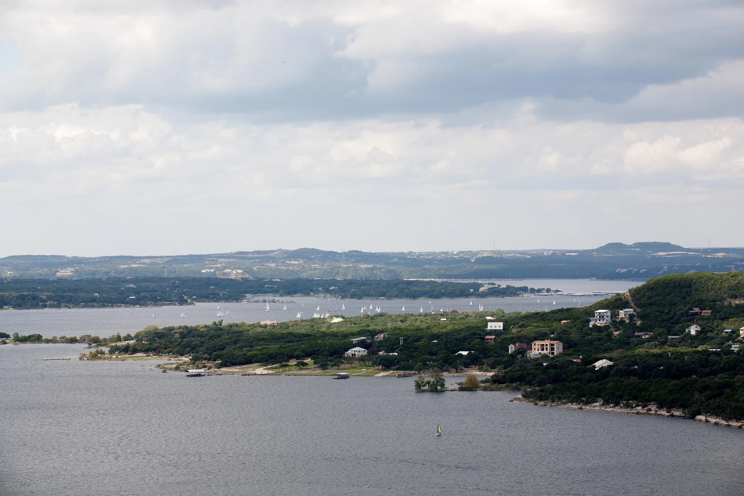
Lake Travis, the Lower Colorado River Authority reservoir behind Mansfield Dam, 17.6 road miles northwest of the Texas Capitol, was 89.4% full at 674.65 feet above sea level on September 29, 2026, according to the Texas Water Development Board's Water Data for Texas, about six feet below its 681-foot full level. Lake Travis is built to rise and fall, so a home on or near it comes with questions a city lot does not: how far the water moves, where the flood elevations sit, who permits the dock and the septic system, and which of a dozen taxing units send a bill. This guide answers each one from LCRA, Travis County and state sources, with August 2026 home prices for the ZIP codes around the lake.
By David Eimer · Austin Journal · 9 minute read · Published
The numbers
- Lake Travis, percent full
- 89.4% (674.65 ft)As of September 29, 2026
84.7% full a year earlier, on September 29, 2025.
Source: Texas Water Development Board, Water Data for Texas ↗
- Full (conservation pool) elevation
- 681 feet above mean sea levelAs of LCRA, checked September 29, 2026
Source: LCRA ↗
- Mansfield Dam spillway and top of flood pool
- 714 feet mslAs of LCRA, checked September 29, 2026
The flood pool above 681 feet holds an additional 776,000 acre-feet.
Source: LCRA ↗
- Road distance, Texas Capitol to Mansfield Dam
- 17.6 milesAs of Computed September 29, 2026
Computed over OpenStreetMap roads from Wikidata's coordinates for the Capitol and the dam; 22.0 miles to Lakeway and 18.1 to Bee Cave. Drive time depends on traffic.
Source: OSRM routing over OpenStreetMap roads (project-osrm.org) ↗
- Lake Travis ISD tax rate
- $1.0329 per $100As of 2026 rate, Travis County Tax Office list saved September 25, 2026
Down from $1.0397 in 2025.
Source: Travis County Tax Office ↗
- Median list price, ZIP 78734
- $750,000As of August 2026
Realtor.com; 250 active listings, 98 median days on market.
Source: Realtor.com Economic Research ↗
Where is Lake Travis, and how big is it?
Lake Travis is a reservoir on the Colorado River northwest of Austin in Travis and Burnet counties, formed by Mansfield Dam. The Texas Water Development Board lists the Lower Colorado River Authority as its owner and operator, dates the dam's completion to May 1942, and gives its purposes as "flood control, water supply, electrical power generation and recreational purposes." Mansfield Dam sits 17.6 road miles from the Texas Capitol, computed over OpenStreetMap roads; the City of Lakeway is 22.0 miles and the City of Lago Vista 34.6.
The size of Lake Travis depends on who is measuring. At full pool the Water Development Board gives 19,297 acres, the LCRA 19,044 acres and Texas Parks and Wildlife 18,622 acres; the agencies use different surveys and datums, so quote one with its source. Texas Parks and Wildlife lists a maximum depth of 190 feet and rates the lake's water-level fluctuation as "High, 10-20 feet."
Lake Travis at a glance
| Measure | Figure | Source |
|---|---|---|
| Owner and operator | Lower Colorado River Authority | Texas Water Development Board |
| Dam and completion | Mansfield Dam, May 1942 | Texas Water Development Board |
| Counties | Travis and Burnet | Texas Parks and Wildlife |
| Full (conservation pool) level | 681 feet above mean sea level | LCRA |
| Surface area at full pool | 19,297 acres (TWDB); 19,044 acres (LCRA); 18,622 acres (TPWD) | Each agency |
| Maximum depth | 190 feet | Texas Parks and Wildlife |
| Level on September 29, 2026 | 674.65 feet, 89.4% full | Water Data for Texas |
| Road miles from the Texas Capitol | 17.6 to Mansfield Dam; 18.1 to Bee Cave; 22.0 to Lakeway; 34.6 to Lago Vista | Computed over OpenStreetMap |
| Public day-use fee, Travis County lake parks | $5 per person; $3 age 62+; free 12 and under; $7 per trailer | Travis County Parks |
The public gets on the lake through Travis County parks. Mansfield Dam Park, "adjacent to Mansfield Dam on the main body of Lake Travis," has what the county calls "the largest public boat ramp on Lake Travis" and a designated swim cove; Pace Bend Park has "more than nine miles of shoreline" and three swimming coves. Day use at both, and at Bob Wentz Park, costs $5 per person, $3 for seniors 62 and older, free for children 12 and under, and $7 per trailer, cash only at the booth.
Sources: Texas Water Development Board ↗ · LCRA ↗ · Texas Parks and Wildlife Department ↗ · OSRM routing over OpenStreetMap roads (project-osrm.org) ↗ · Travis County Parks ↗ · U.S. Census Bureau ↗ · Wikidata ↗
Where are the homes around Lake Travis?
Most homes around Lake Travis sit outside the City of Austin, even with an Austin mailing address. The Travis County Tax Office's 2026 rate list includes separate governments for the City of Lakeway, the City of Bee Cave, the City of Lago Vista, the City of Jonestown and the villages of Briarcliff, Point Venture and Volente, plus unincorporated areas served by water districts such as Travis County WCID No. 17. Lake Travis Fire Rescue, which is Travis County Emergency Services District No. 6, says its Station 601 "services the majority of shoreline property of Lake Travis," naming Hudson Bend, Apache Shores, Vineyard Bay, Costa Bella, Lake Wind and Cardinal Hills.
That patchwork decides who issues a building permit, who regulates the septic system and which tax bills arrive. The rest of this guide takes each question in the order a buyer meets it: water level, flooding, the dock and lake water, the septic system, and then taxes and prices.
Sources: Travis County Tax Office ↗ · Lake Travis Fire Rescue ↗
How full is Lake Travis right now?
Lake Travis was 89.4% full on September 29, 2026, at 674.65 feet above mean sea level, according to Water Data for Texas, which reports the conservation storage as 981,758 acre-feet of a 1,098,044 acre-foot capacity. A year earlier, on September 29, 2025, the lake was 84.7% full. The LCRA's own Hydromet gauge at Mansfield Dam read 674.69 feet on the evening of September 29, 2026.
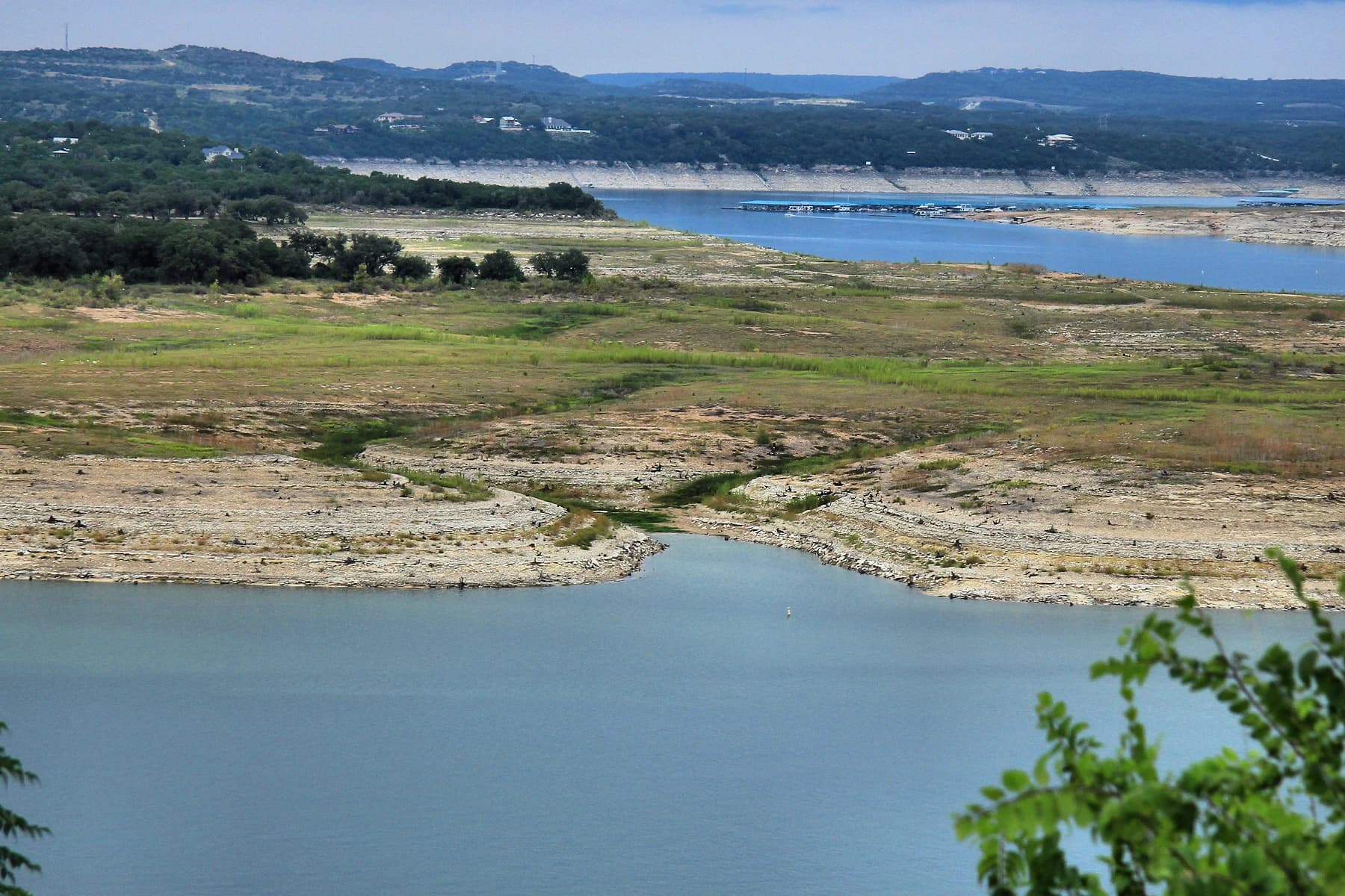
The number moves by design. The LCRA says "Lakes Buchanan and Travis were designed to fluctuate, going up while capturing water during rainy times and going down as water is used or evaporates when the weather turns drier." The LCRA's recorded range runs from a low of 614.18 feet on August 14, 1951, to a high of 710.44 feet on December 25, 1991, a spread of about 96 feet (computed from the two LCRA figures).
Lake Travis elevations: current level, records and LCRA flood operations (feet above mean sea level)
| Elevation | What it means | Source date |
|---|---|---|
| 754 ft | Top of Mansfield Dam | LCRA, checked Sept. 29, 2026 |
| 714 ft | Spillway; water flows over it above this level | LCRA, checked Sept. 29, 2026 |
| 710.44 ft | Record high, Dec. 25, 1991 | LCRA |
| 683-710 ft | LCRA may release up to 30,000 cfs if the river stays below set levels | LCRA, checked Sept. 29, 2026 |
| 681 ft | Full for water supply; floodgate releases can begin above it | LCRA, checked Sept. 29, 2026 |
| 674.65 ft | Level on Sept. 29, 2026 (89.4% full) | Water Data for Texas |
| 614.18 ft | Record low, Aug. 14, 1951 | LCRA |
For a buyer, the level on the day of a showing says little about the view or the dock in a dry year. Ask the seller which way the shoreline slopes, at what lake level the dock floats free and at what level it sits on the bottom, and whether the listing photographs were taken near full pool. A lot on a steep bank and one on a shallow cove can look alike at 681 feet and very different at 640.
Sources: Texas Water Development Board, Water Data for Texas ↗ · LCRA Hydromet ↗ · LCRA ↗
What happens to Lake Travis homes in a flood?
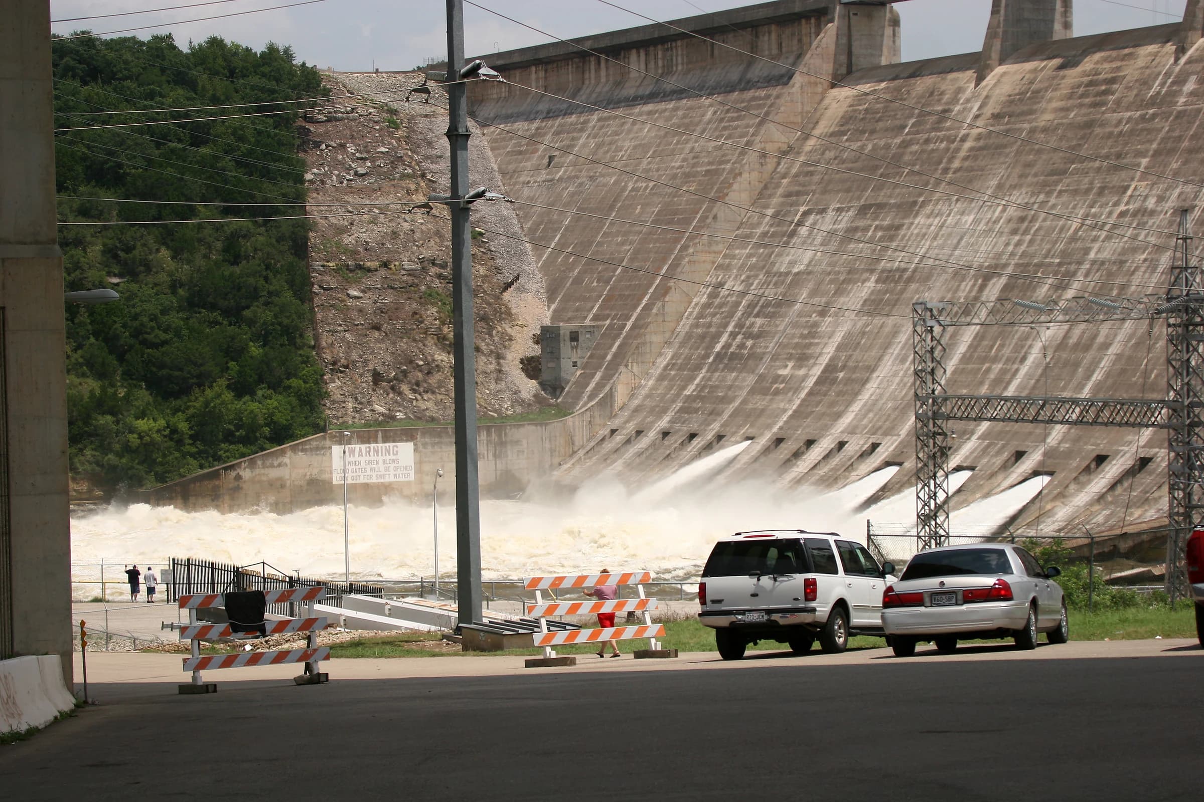
Lake Travis is the only lake in the Highland Lakes chain designed to hold back floodwater, and the LCRA says its flood pool above 681 feet "holds an additional 776,000 acre-feet (31 Lake Austins' worth) to reduce downstream flooding." Water flows over the Mansfield Dam spillway when the lake rises above 714 feet, and 754 feet is the top of the dam. Between 681 and 714 feet the LCRA releases water through floodgates at rates tied to river conditions downstream, so the lake can stay high for days after a storm.
That is not hypothetical. On July 17, 2026, the LCRA announced it would open at least two floodgates at Mansfield Dam on Saturday, July 18, "the first floodgate operation there since 2019." A home whose lowest floor, driveway, septic field or boathouse sits a few feet above 681 is inside the range the lake is built to fill.
In unincorporated Travis County, Chapter 464 of the county code sets a "minimum flood protection elevation" of two feet above the 1 percent annual chance floodplain for property in the Colorado River Corridor floodplain, and Section 464.061 requires a development permit "before any construction or other development begins" in unincorporated Travis County. Before an offer, look up the lot on the FEMA map, ask for an elevation certificate, and compare the lowest floor with the elevations in the LCRA table; the Austin flood map guide walks through the lookup.
Sources: LCRA ↗ · LCRA news release ↗ · Travis County Code Chapter 464, Floodplain Management (amendments through October 21, 2025) ↗
Can you build a dock or pump water from Lake Travis?
Docks on Lake Travis follow LCRA rules, not the City of Austin's, which govern Lake Austin downstream. The LCRA says it "does not require a permit, registration or fees for residential docks of 1,500 square feet or less," and that a dock on Lake Travis may extend no more than 100 feet from the shoreline. Owners "must own or have permission to use the submerged land under a fixed dock" and the underwater land used for a floating dock's anchors, and every dock must meet the LCRA's Safety Standards for Residential Docks on the Highland Lakes, covering flotation, lighting, access and anchoring.
Pumping lake water for a lawn needs a contract. The LCRA says "lakeside residential property owners must have a domestic use water contract with LCRA to pump water from one of the Highland Lakes," for up to 10 years and up to 10 acre-feet a year. The rate is $165 per acre-foot, rising to $175 in January 2027, with a minimum contract of three-quarters of an acre-foot at $123.75 a year. Ask the seller whether the property has a contract and whether the pump in the photographs is covered by it.
Zebra mussels are part of lake ownership too. Texas Parks and Wildlife declared Lake Travis infested with "an established, reproducing population" on June 27, 2017, and warned the mussels "clog public-water intakes, and damage boats and motors left in infested waters." Budget for dock, lift and intake maintenance accordingly, and have the inspector note the condition of submerged hardware.
Sources: LCRA ↗ · Texas Parks and Wildlife Department news release ↗
Who permits septic systems near Lake Travis?
Many homes around Lake Travis run on an on-site sewage facility, and near the shore the regulator is the LCRA. The LCRA has regulated septic systems "in a 2,000-foot zone around Lake Travis" since September 1971, as an authorized agent of the Texas Commission on Environmental Quality. A new system needs an application with a site evaluation and design, LCRA inspections during installation and a final permit to operate.
A sale can trigger paperwork. The LCRA's continued-use rules say "any change in ownership after six months from the last reinspection approval will require a new application, fee and inspection." Ask early whether the system inside the 2,000-foot zone has a current reinspection approval and who is paying for the new one, because it has to fit inside the option period along with the home inspection.
Larger projects face a second LCRA rule. The Highland Lakes Watershed Ordinance applies to land modification "within the Lake Travis watershed in Travis County" and requires a development permit when a project adds more than 10,000 square feet of impervious cover or disturbs more than an acre. A pool and a driveway on a single lot usually fall under that line, but a teardown and rebuild on a large tract may not, so check before pricing a renovation.
Sources: LCRA ↗
How much do homes on Lake Travis cost?
Home prices around Lake Travis vary more by ZIP code than by the lake itself. Realtor.com's August 2026 data puts the median list price at $750,000 in 78734, $999,000 in 78738, $892,000 in 78732 and $967,500 in 78669, against $450,000 for the Austin metro. Those medians include homes with no water view and do not describe any single waterfront street; the share of listings with a price cut ran from 17.6% in 78669 to 32.7% in 78732.
Lake Travis-area ZIP codes, Realtor.com August 2026
| ZIP | Median list price | Change vs. a year earlier | Active listings | Median days on market | Listings with a price cut | Median $/sq ft |
|---|---|---|---|---|---|---|
| 78734 | $750,000 | -1.3% | 250 | 98 | 24.4% | $312 |
| 78738 | $999,000 | +8.7% | 239 | 76 | 24.9% | $302 |
| 78732 | $892,000 | -9.2% | 105 | 60 | 32.7% | $285 |
| 78669 | $967,500 | +1.0% | 271 | 108 | 17.6% | $347 |
| Austin metro | $450,000 | -9.8% | 12,517 | 73 | 27.6% | $231 |
A median list price is an asking price, not a sale price, and a waterfront lot, a water-view lot and a house a mile inland can share a ZIP code. For a specific street, ask for recent closed sales from the MLS, and read the lake-specific items in this guide, the dock, the septic record and the flood elevations, as part of the price. The Leander market page carries the same Realtor.com figures for a neighboring suburb.
Sources: Realtor.com Economic Research ↗
What are property taxes around Lake Travis?
Property taxes around Lake Travis stack a county, a hospital district, a school district, an emergency services district and often a city or a water district. On the Travis County Tax Office's 2026 list, saved September 25, 2026, Lake Travis ISD's rate is $1.0329 per $100 of value (down from $1.0397), Leander ISD's is $1.1169 and Lago Vista ISD's is $1.0169. Travis County ESD No. 6 is $0.093639. The City of Lakeway and the City of Lago Vista had not posted a 2026 rate on that list.
Tax rates for taxing units around Lake Travis, per $100 of value, 2025 and 2026
| Taxing unit | Type | 2025 rate | 2026 rate |
|---|---|---|---|
| Travis County | County | $0.375845 | $0.386210 |
| Travis Central Health | Hospital district | $0.118023 | $0.132863 |
| Lake Travis ISD | School district | $1.0397 | $1.0329 |
| Leander ISD | School district | $1.0869 | $1.1169 |
| Lago Vista ISD | School district | $1.0169 | $1.0169 |
| Travis County ESD No. 6 | Emergency services district | $0.090399 | $0.093639 |
| City of Lakeway | City | $0.16964 | Not posted |
| City of Bee Cave | City | $0.02 | $0.02 |
| City of Lago Vista | City | $0.42 | Not posted |
| City of Jonestown | City | $0.3981 | $0.4191 |
| Village of Briarcliff | Village | $0.0759 | $0.08451 |
| Village of Point Venture | Village | $0.085828 | $0.085828 |
| Village of Volente | Village | $0.0778 | $0.084708 |
| Travis County WCID No. 17 | Water district | $0.056 | $0.06 |
| Hurst Creek MUD | Municipal utility district | $0.2275 | $0.2205 |
| Lakeway MUD | Municipal utility district | $0.0531 | $0.0531 |
The Austin property tax guide shows how to turn rates into a bill, and the homestead exemption guide lists which of these units grant one. Bring David the address and he can pull the parcel's taxing units, flood zone and septic record together before you write an offer, or start with the Austin market data and a payment estimate on the home search.
Sources: Travis County Tax Office ↗
Common questions
Is Lake Travis in Austin, Texas?
Lake Travis is northwest of Austin in Travis and Burnet counties, and Mansfield Dam sits 17.6 road miles from the Texas Capitol. Most homes around the lake are in smaller cities and villages such as Lakeway, Bee Cave, Lago Vista, Jonestown, Briarcliff, Point Venture and Volente, or in unincorporated Travis County, even when the mailing address says Austin.
How full is Lake Travis today?
Lake Travis was 89.4% full at 674.65 feet above mean sea level on September 29, 2026, according to Water Data for Texas, about six feet below the 681-foot full level. A year earlier it was 84.7% full. The LCRA Hydromet site posts the gauge reading at Mansfield Dam several times an hour.
How much do homes on Lake Travis cost?
Realtor.com's August 2026 median list prices for ZIP codes around Lake Travis were $750,000 in 78734, $892,000 in 78732, $967,500 in 78669 and $999,000 in 78738, against $450,000 for the Austin metro. Those medians mix waterfront, water-view and inland homes, so closed sales on the specific street matter more.
Do you need a permit for a boat dock on Lake Travis?
The LCRA does not require a permit, registration or fee for a residential dock of 1,500 square feet or less on Lake Travis. The dock may extend no more than 100 feet from shore, must meet the LCRA's residential dock safety standards, and the owner must own or have permission to use the submerged land under it.
Who regulates septic systems on Lake Travis?
The LCRA regulates on-site sewage facilities in a 2,000-foot zone around Lake Travis, a role it has held since September 1971. Under its continued-use rules, a change in ownership more than six months after the last reinspection approval requires a new application, fee and inspection.
Take this to your next conversation
- Compare the lot's lowest floor, septic field and dock with the LCRA's 681-foot full level and 714-foot spillway level.
- Ask for the FEMA flood zone and an elevation certificate, and check Travis County's floodplain rules if the lot is unincorporated.
- Confirm the LCRA septic reinspection status and who pays for the new application after closing.
- Ask whether the property has an LCRA domestic water contract for any lake pump.
- Check who owns the submerged land under the dock and at what lake level the dock grounds.
- Pull every taxing unit on the TCAD record, including the city, ESD, WCID or MUD.
Sources and review date
Sources checked . Planning suggestions are editorial guidance; current property facts and requirements need an address-specific check.
- Texas Water Development Board, Water Data for Texas: Lake Travis ↗
- LCRA Hydromet: Current lake levels with monthly averages ↗
- Texas Water Development Board: Lake Travis (Colorado River Basin) ↗
- Texas Parks and Wildlife Department: Fishing Lake Travis (lake characteristics) ↗
- Travis County Parks: Mansfield Dam Park ↗
- Travis County Parks: Pace Bend Park ↗
- Travis County Parks: Bob Wentz Park ↗
- OSRM routing over OpenStreetMap roads (project-osrm.org) ↗
- Wikidata: Texas State Capitol (Q2078042) and Mansfield Dam (Q6751639), coordinates ↗
- U.S. Census Bureau: 2024 Gazetteer, Texas places (internal points for Lakeway, Bee Cave, Lago Vista) ↗
- LCRA: Highland Lakes and Colorado River ↗
- LCRA: LCRA dams form the Highland Lakes ↗
- LCRA: Flood ↗
- LCRA: Mansfield Dam flood operations (key elevations for Lake Travis) ↗
- LCRA news release: LCRA to begin floodgate operations at Mansfield Dam (July 17, 2026) ↗
- Travis County Code Chapter 464, Floodplain Management (amendments through October 21, 2025) ↗
- LCRA: Buoys, docks and marinas ↗
- LCRA: Domestic water use ↗
- Texas Parks and Wildlife Department news release: Invasive zebra mussels discovered in Lake Travis (June 27, 2017) ↗
- LCRA: On-site sewage facilities program ↗
- LCRA: Steps for continued use of an on-site sewage facility ↗
- LCRA: Highland Lakes Watershed Ordinance ↗
- Lake Travis Fire Rescue: Fire stations ↗
- Travis County Tax Office: tax rates by taxing unit, 2026 and prior years (spreadsheet, saved September 25, 2026) ↗
- Realtor.com Economic Research: monthly housing inventory by ZIP code and metro ↗